Find out more
Contact Barwon Coast at the following

11 November 2026
Expressions of interest are now open for temporary summer food vendor permits across Barwon Coast Caravan Parks from 19 December 2026 to 31 January 2027.
9 November 2026
Three chicks thriving and a new nest
5 November 2026
Three chicks have hatched at Barwon Bluff South
3 November 2026
Two nests have failed and two remain along our coastline.
3 November 2026
Barwon Coast has launched its new Foreshore Master Plan, setting a shared direction for the management of 22 kilometres of coastline over the next 15 years.
Published on 18 February 2026
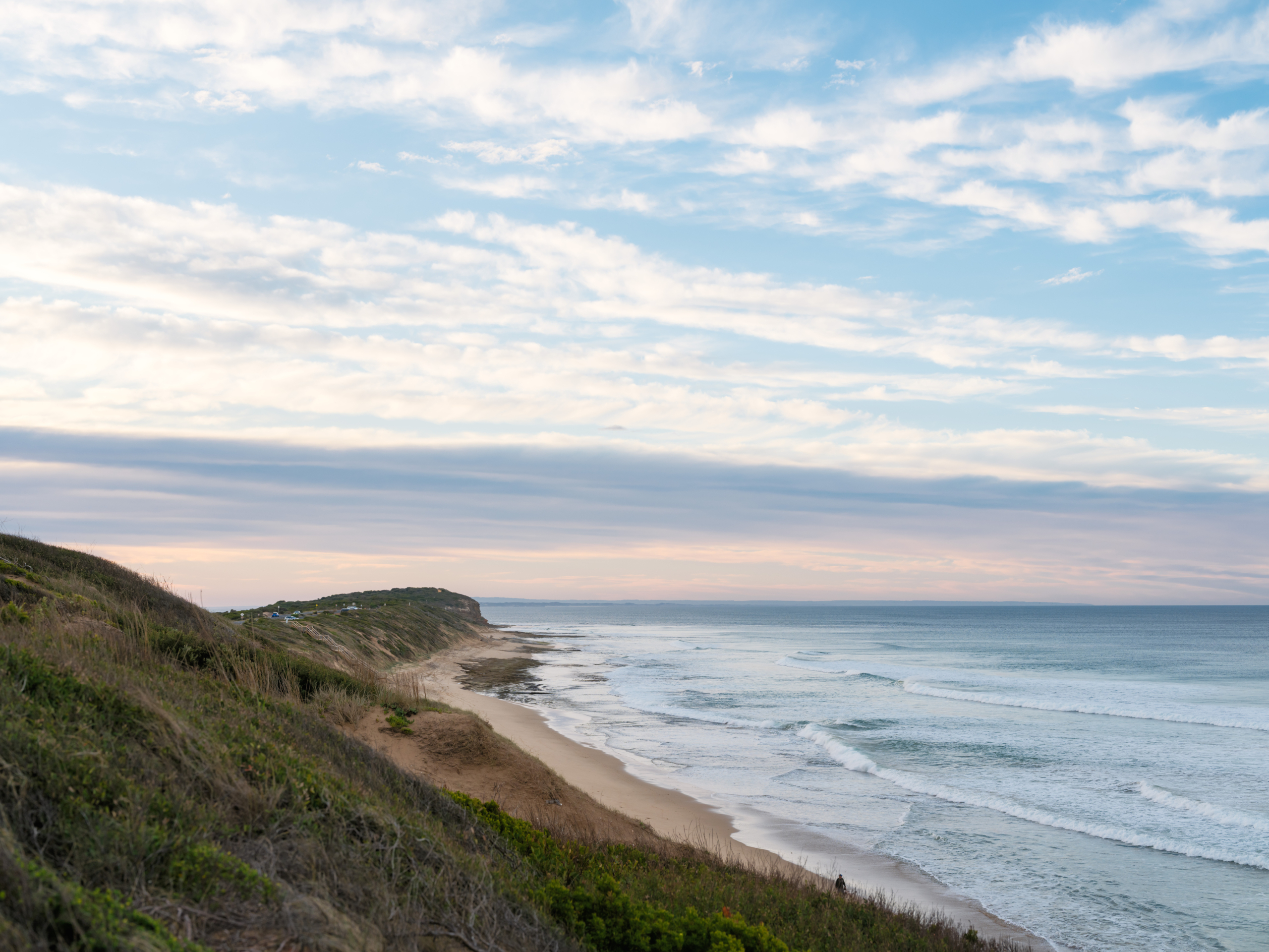
The coast is dynamic and always changing, shaped by natural coastal processes such as erosion and inundation, and at times, natural processes may impact on coastal values and uses. When this occurs, we refer to the processes as ‘coastal hazards’.
Coastal hazard exposure is expected to increase with changes in wave action, storm activity and sea level rise associated with climate change.
Barwon Coast is releasing the Coastal Hazards Exposure Report for the land it manages. The report uses the best available science and local knowledge to refine our understanding of coastal hazard risks, informing safer, more resilient future planning, particularly our Foreshore Master Plan.
The Foreshore Master Plan community engagement found Foreshore that ecological fragility, dune care, and habitat restoration are the strongest community priorities (see the Community Engagement Report here).
Coastal hazards are one of many natural hazards that can occur in areas we enjoy living in and visiting (e.g. bushfire, river flooding, air quality). Improved assessment and mapping of hazards enables us to create a plan to reduce the potential risks and adapt.
We have a responsibility to consider their risk exposure, and act in accordance with the Marine and Coastal Policy 2020.
We are taking a partnership approach to managing coastal hazard risk and proactively adapt, both now and in the long-term. Our approach is following the direction of the Marine and Coastal Policy 2020 and Victoria’s Resilient Coast – Adapting for 2100+ framework and guidelines.
This project increases our understanding of coastal hazard exposure for the coastline we manage, starting with helping shape the actions in the Foreshore Master Plan.
The coastal hazards being assessed in the Coastal Hazard Exposure Report are coastal erosion and coastal inundation on Barwon Coast-managed land.
This report, along with community input and other plans, audits, and strategies, will help inform and shape the actions and directions included in the Foreshore Master Plan, as well as the Coastal Marine Management Plan (CMMP) and other future planning undertaken by Barwon Coast.
We invite the community and visitors to view the Barwon Coast Foreshore Coastal Hazard Exposure report to understand potential future impacts of erosion and inundation along the foreshore.
Read the Coastal Hazard Exposure Report
On Thursday 5 March we held an Online Information Session about the Coastal Hazards Exposure Report.
The expert team who worked with Barwon Coast to create the Coastal Hazards Exposure Report, Water Technology, provided an overview of the report and address key frequently asked questions.
The Victorian Department of Energy, Environment and Climate Action (DEECA) has led the development of ‘Victoria’s Resilient Coast – Adapting for 2100+’ – a strategic approach for coastal hazard risk management and adaptation.
‘Victoria’s Resilient Coast – Adapting for 2100+’ provides a framework, guidelines, and support for Local Government, land managers and their communities to:
In building on the Policy directions, Victoria’s Resilient Coast provides a staged approach to the technical, strategic and engagement elements of risk management and adaptation.
This report is already shaping the actions in the draft Foreshore Master Plan, which will guide the protection, enhancement, and connection of key areas over a 15-year period.
The Foreshore Master Plan will be shared with the community for feedback in early 2026, and we encourage all community members to review the Foreshore Master Plan and share their thoughts. The final Master Plan is expected to be released mid-2026.
To stay up to date on opportunities to have your say on the Draft Foreshore Master Plan, please click the link below.
Keep me up to date with the Foreshore Master Plan
The Coastal Hazards Exposure Report uses the best available science and local knowledge to refine our understanding of coastal hazard risks, informing safer, more resilient future planning.
The majority of the Coastal hazard information included in the Report is currently publicly available at the regional, state and national scale to assist communities and land managers with proactive planning.
This includes inundation and sea level rise scenarios through the City of Greater Geelong’s ‘Our Coast’ study, Coastal Risk Australia, and Victorian assessments through CoastKit (marineandcoasts.vic.gov.au).
The technical assessments completed for this project will assist to refine our understanding of coastal hazard exposure for our local area and inform the Foreshore Master Plan.
No, this report only covers coastal foreshore areas managed by Barwon Coast, extending from Breamlea/Bancoora in the west, to the Collendina Bonnyvale Road beach access to the east.
We work with the following land managers and authorities – if the area you’d like to know more about is managed by another organisation, please contact them for further information:
This project helps manage the coast by providing a clear understanding of areas exposed to erosion and inundation, which informs long-term planning and decision-making. The Coastal Hazard Exposure report identifies risks to foreshore land and infrastructure, helping Barwon Coast and partners plan for adaptation, maintain key assets, and engage the community about future coastal management.
Natural coastal processes like wind, waves, tides and currents work to shift sediment and shape the coastline. When these processes negatively impact on use of the coast, they become coastal hazards. These impacts could be environmental, social, cultural or economic impacts. Coastal hazards include coastal erosion and inundation.
Coastal hazards for the coastal foreshore areas managed by Barwon Coast at Breamlea/Bancoora Beach (between Black Rock and Thompson Creek) presented in this study were developed as part of the Bancoora Coastal Adaptation Plan (‘BCAP’) project. The BCAP project covers Stages 1-5 of Victoria Resilient Coast: Adapting for 2100+ which is being delivered separately by Alluvium Consulting.
The results from Stage 3 Coastal Hazard Exposure of the BCAP project have been integrated into the mapping of this study to provide a consistent set of hazard layers across the management area.
The BCAP project then goes further and builds on this coastal hazard information to assess risk (Stage 4) and develop adaptation pathways (Stage 5).
Under the Marine and Coastal Policy 2020, Committees of Management are required to manage the coast to protect and enhance the coastal values for future generations. This includes considering appropriate coastal use and adaptation in response to coastal hazards. To successfully implement coastal planning, Barwon Coast requires mapping of existing and future coastal hazards as this information is vital for adaptation planning.
Water Technology was commissioned to provide Barwon Coast with existing and future coastal hazard mapping from Breamlea to Collendina to help inform Barwon Coast’s long-term strategic goals.
ℹ️ Service disruption – Microsoft outage
Barwon Coast is currently experiencing some system disruptions due to the global Microsoft issue, which may affect our ability to respond to enquiries as quickly as usual.
If your enquiry is urgent, please give us a call on (03) 5254 1118.
Thanks for your patience and understanding. We`ll keep you updated and let you know when we are back to normal.

A little kindness goes a long way.
This World Kindness Day, we`re encouraging everyone in our coastal communities to show kindness to one another, to our environment and to the people who care for it.
Our Barwon Coast team works hard, and with heart, every day to care for the coast we all love. Whether they`re maintaining our beaches and facilities, protecting our natural environment or helping visitors enjoy their time on the coast, they do so with pride and dedication.
We ask our community to extend the same care and respect to our staff that they show to our coastline.
A friendly smile, a kind word or a simple thank you can make someone`s day. Be kind to each other. Be kind to our staff. Be kind to our coast. 💙
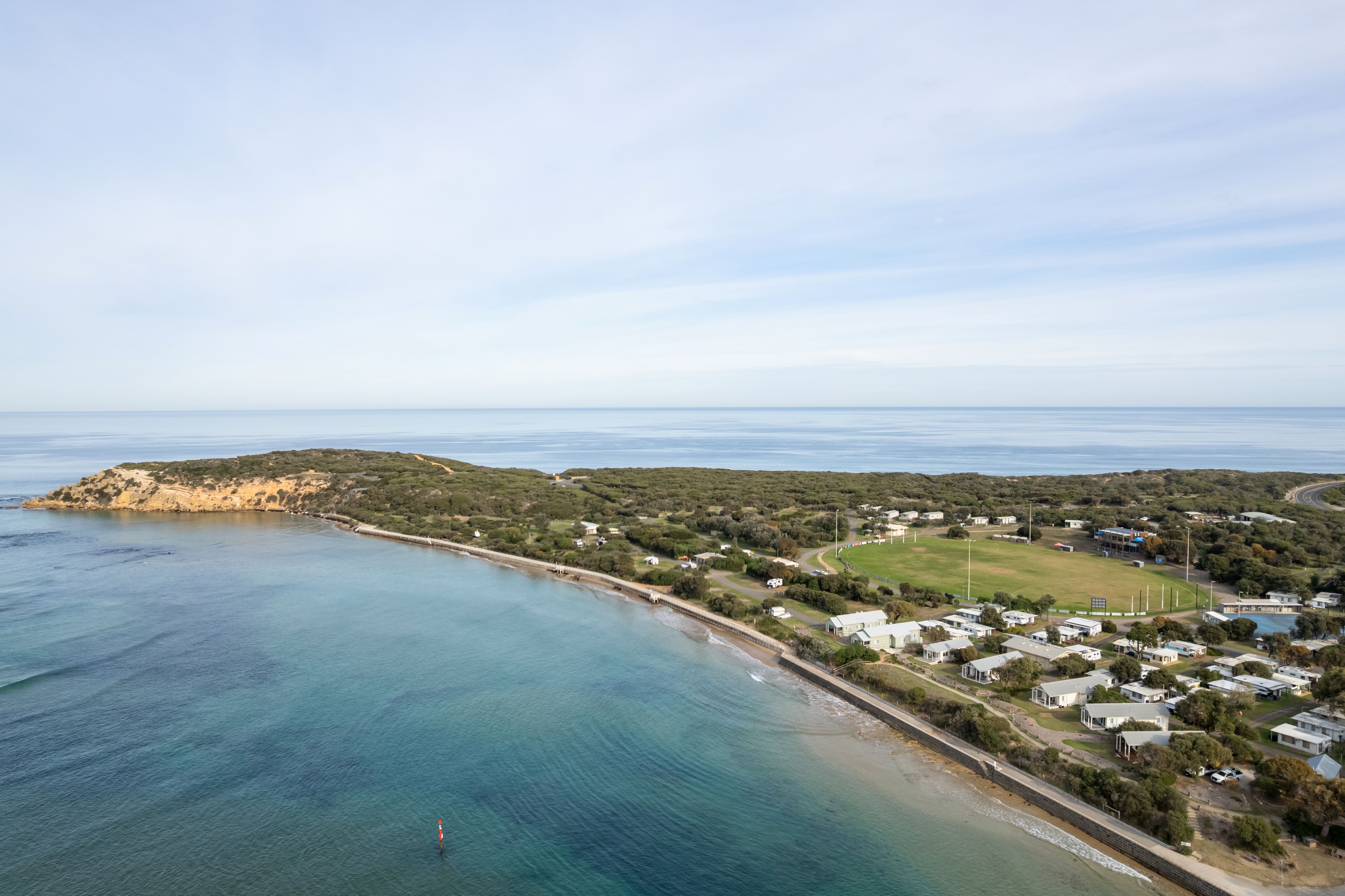
The coastal skies can be so much more interesting than just clear blue (although we do love a sunny day on the coast!). This pic by one of our clever staff members gives yet another new perspective on the Bluff, sea and skies 🤩 What a magical place to live, work or visit - we are so lucky.
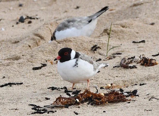
A little chick, with a watchful parent close by! 🐣
Filmed on Monday at Barwon Bluff, this Hooded Plover chick is one of three that hatched last week. All three chicks were last sighted yesterday and are still going strong!
A big thank you to Friends of the Hooded Plover Bellarine for their incredible work monitoring these vulnerable birds and for sharing this precious footage with us.
Please continue to respect beach closures and follow signed detours to give these little ones the best chance of survival.
🚧 Temporary beach access closure – Thirteenth Beach
The car park and beach access path at Thirteenth Beach sand ramp beach access (Emergency Marker THI182, formerly 40W) will be temporarily closed on Friday 13 November 2026 for essential track surface repairs.
Works are expected to take one day.
Thanks for your patience while we complete these important maintenance works to keep our coastal access tracks safe.
"They shall grow not old, as we that are left grow old:
Age shall not weary them, nor the years condemn.
At the going down of the sun and in the morning
We will remember them."
– Laurence Binyon, For the Fallen
Today, we honour those who have served and sacrificed in times of war, conflict and peacekeeping.
We also acknowledge the service and sacrifice of Aboriginal and Torres Strait Islander peoples who have served in defence of our country and the freedoms we enjoy today.
At 11 am, we join Australians across the country in observing one minute`s silence to remember all who have served and sacrificed.
Lest we forget. 🌺
💙 Hooded Plover update – Three chicks and a new nest!
Some positive news from our coast today (9 November)!
🐣 Barwon Bluff South: All three chicks are now five days old and were spotted foraging on the intertidal reef this morning.
🥚 Thirteenth Beach at Boings: A new nest has been discovered with three eggs!
How you can help:
💙 Do not enter the closed section of beach between The Bluff Dune South and The Hole beach accesses.
💙 Follow the signed pedestrian detours.
💙 At Thirteenth Beach at Boings, keep dogs on lead and walk close to the waterline.
💙 Follow local signage and give nesting birds and chicks plenty of space.
Thank you for helping give these vulnerable shorebirds the best chance of survival! And a big thank you to Friends of the Hooded Plover Bellarine for their ongoing monitoring efforts and for sharing this wonderful video with us!
Find out more, including the beach closure map, on our website news section (link in bio).
The magic of the sun rising over this beautiful stretch of coastline will never be taken for granted - at Barwon Coast, we count ourselves lucky to be tasked with caring for the coast. Do you love to catch a sunrise, or a sunset, at the beach? Where are the best vantage points? What about a sunrise swim, like the @sunrise.hunter_ group that meets every morning at Ocean Grove Main Beach all year round?
📣 Did you know you can report an issue via our website?
Whether it`s vandalism to one of the facilities we manage, a maintenance issue or something else that needs fixing, you can let us know using our online reporting form.
Our team will review your report as soon as possible and follow up where required.
💻 Report an issue via our website (link in bio)
Thanks for helping us care for our coast!
P.S. This is an old pic
💙 Three Hooded Plover chicks have hatched at Barwon Bluff South! 🐣
Three Hooded Plover chicks hatched today (5 November), marking a positive milestone in this year`s breeding season.
To protect the chicks, a temporary beach closure is being established between The Bluff Dune South and The Hole beach accesses for approximately five weeks, until the chicks can fly and are considered self-sufficient.
💙 Please respect the closure and follow local signage and barriers.
💙 Follow the signed pedestrian detour or explore one of our other beautiful local beaches while the chicks grow.
💙 Keep dogs away from the protected area and give the chicks plenty of space.
A big thank you to the Friends of the Hooded Plover – Bellarine volunteers for their ongoing efforts!
Read the full update, including the beach closure map on our news story on our website - link in bio

This is Wadawurrung Country. We acknowledge the Wadawurrung People as the Traditional Owners of the land, waters, seas and skies of Ocean Grove, Barwon Heads, 13th Beach, Black Rock and Breamlea. We honour and say Nyatne to Elders past, present and future whose ancestors, for thousands of years, have cared for this part of Dja (Country). We are committed as an organisation to meaningfully work together with Traditional Owners to make Wadawurrung Culture and Country strong.
© 2026 Barwon Coast. Website by Residency Studios.