Find out more
Contact Barwon Coast at the following

26 October 2026
Two nests have failed and two remain along our coastline.
26 October 2026
Expressions of interest are now open for temporary summer food vendor permits across Barwon Coast Caravan Parks from 19 December 2026 to 31 January 2027.
15 October 2026
Great news for Hooded Plovers, with two new nests identified at Thirteenth Beach
13 October 2026
Filming for a car commercial is taking place in Barwon Heads on Wednesday 14 October.
7 October 2026
Hooded Plover breeding season is underway across our coast, with a new nest now confirmed.
Stage 1: Community survey open 100%
Stage 2: Community and Stakeholder Design workshops 100%
Stage 3: Developing a draft Master Plan 100%
Stage 4: Draft Master Plan released for feedback 100%
Stage 5: Community Information Sessions %
Stage 6: Incorporate feedback and develop final Master Plan %
Final Master Plan released %
Published on 12 December 2024
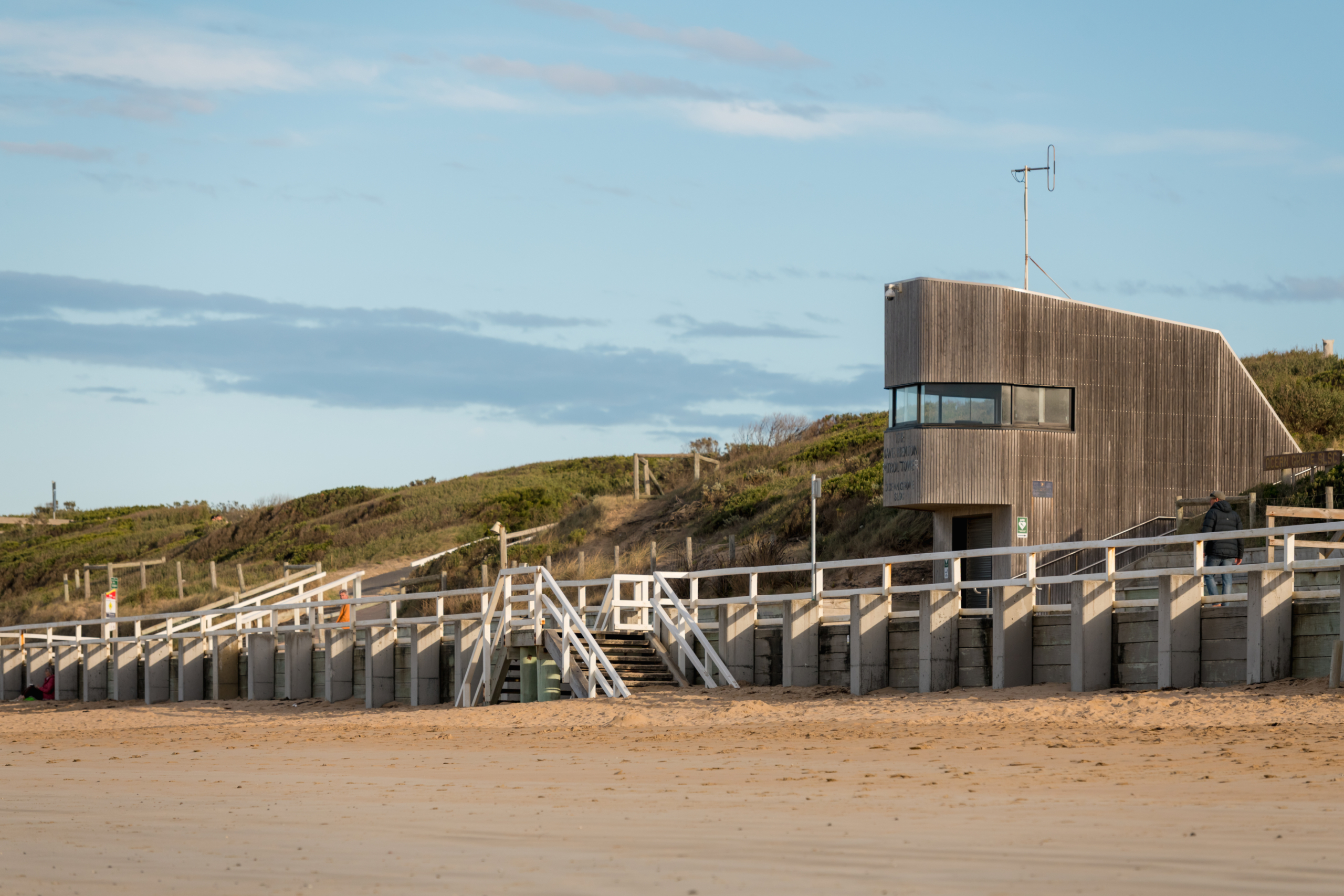
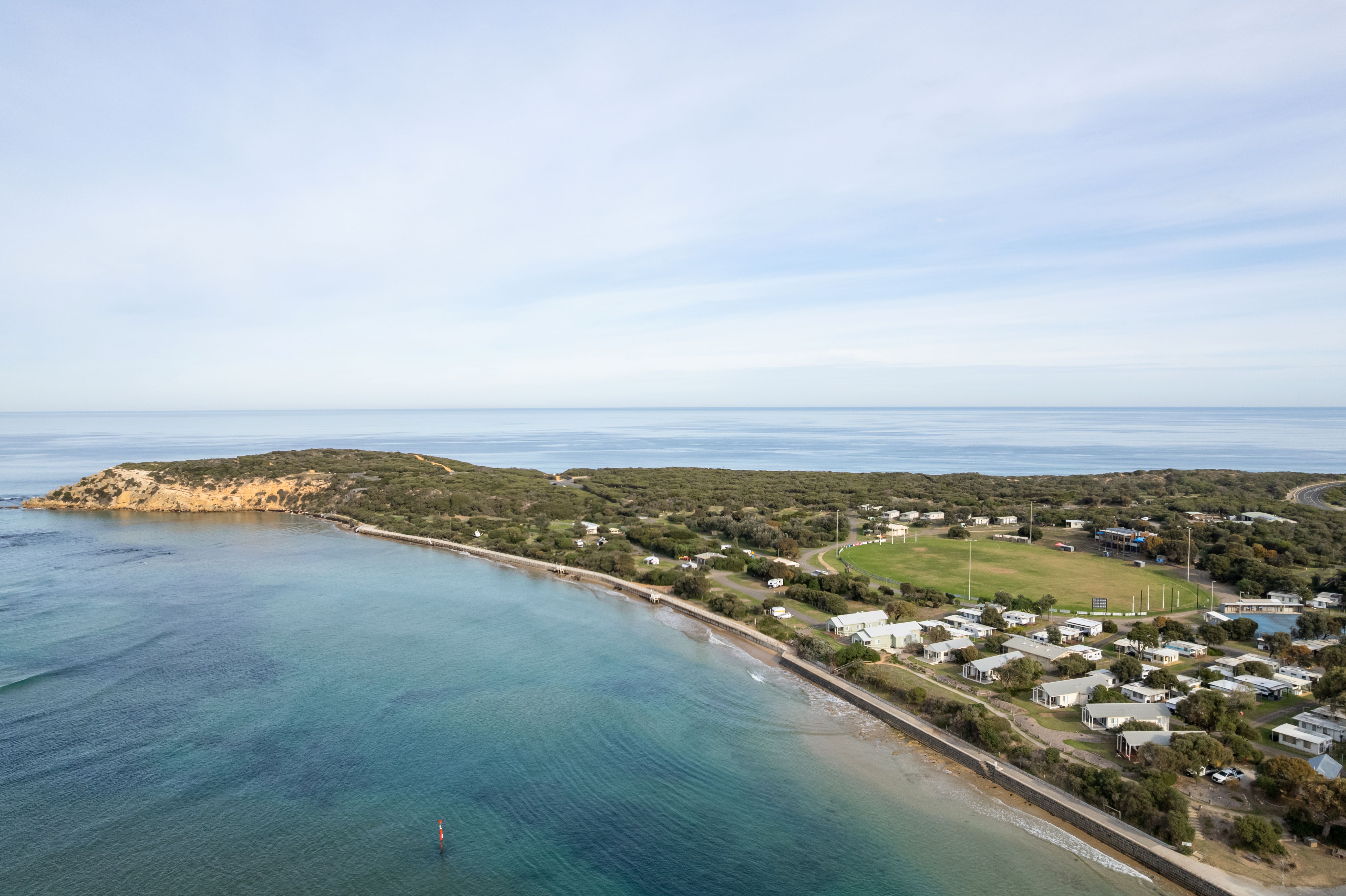
The Barwon Coast Foreshore Master Plan (draft) sets a clear, long-term direction for one of Victoria’s most valued coastal landscapes, spanning approximately 22 kilometres of coastal Foreshore from Breamlea to Collendina.
Prepared by Barwon Coast in partnership with Hatch Design, the Master Plan establishes a forward-looking, landscape-first framework for all public coastal land under its care, including Bancoora Beach, Black Rock, Thirteenth Beach, Barwon Bluff, Barwon Heads Foreshore, Bukareeyoo, Ocean Grove Main Beach, and Collendina.
Community consultation on the Draft Barwon Coast Foreshore Master Plan was open from 1 June to 6 July, 2026, and has now closed.
Barwon Coast would like to sincerely thank everyone who took the time to engage with the Draft Plan, whether by attending a community information session, participating in a stakeholder briefing, completing the online survey or making a formal submission.
Throughout the consultation period, we received valuable feedback from community members, Traditional Owners, government agencies, local organisations and other stakeholders. We are grateful for the time, knowledge and perspectives shared, which will help strengthen the final Plan.
Barwon Coast will now review all submissions and survey responses received during the consultation period.
Feedback will be carefully considered alongside technical advice and project objectives as we refine the Draft Foreshore Master Plan. Where appropriate, changes will be made before the final Plan is presented to the Barwon Coast Committee of Management for consideration.
Once finalised, the Foreshore Master Plan will provide a strategic framework to guide the care, management and enhancement of the Barwon Coast foreshore over the next 15 years.
Thank you again to everyone who contributed to this important project. We look forward to sharing the final Foreshore Master Plan with the community later this year.
The draft Foreshore Master Plan was shaped by community voices – and grounded in evidence. A comprehensive engagement processes was undertaken:
This process committed to deep listening, capturing issues, values, memories, behaviours, and lived experience.
Thank you to everyone who shared their ideas and insights during the initial Foreshore Master Plan engagement period. This included community members, Traditional Owners, staff, Barwon Coast Committee, the Community Reference Group, and visitors. Your contributions are helping shape the future of the Barwon Coast.
To capture this input, we prepared two reports:
Four key technical documents are guiding this work:
These strategies, reports and audits are essential tools in shaping future actions. They provide evidence-based direction that supports the values and aspirations expressed by the community.
To stay up to date on this project including notification of the final Foreshore Master Plan release, please click the link below.
The Barwon Coast Foreshore Master Plan is a 15-year guide for the protection, access, improvement and long-term care of approximately 22 kilometres of coastal Crown land managed by Barwon Coast, from Breamlea to Collendina.
This is Wadawurrung Warri Dja (Sea Country). The Master Plan begins with recognition of Wadawurrung cultural authority and the continuing relationship between Wadawurrung People, land, water, coast, culture and story.
The Master Plan responds to increasing visitation and coastal vulnerability, and has been prepared to support a coordinated, values-led and Country-first approach to managing the Foreshore as a single, interconnected cultural, ecological and community landscape.
Barwon Coast worked closely with Wadawurrung Traditional Owners Aboriginal Corporation, state and local government agencies, and key stakeholders to develop a comprehensive and inclusive plan. A Community Reference Group, formed in late 2024, has helped ensure the plan reflects the needs and aspirations of the community and visitors.
The Foreshore Master Plan is a key action out of Barwon Coast’s Coastal and Marine Management Plan 2020-2025, which provides the foundation for this Master Plan.
Barwon Coast Committee of Management Inc (Barwon Coast) is delegated by the Victorian Minister for Environment to manage 22km of the coast along Victoria’s Bellarine Peninsula. This includes the beaches and foreshores of Collendina, Ocean Grove, Barwon Heads, 13th Beach, Black Rock and Breamlea. In partnership with Traditional Owners, Barwon Coast’s charter is to protect and enhance the natural environment and provide opportunities for residents and visitors to enjoy these areas.
Barwon Coast operates three caravan parks and one campground in the foreshore reserve, as well as managing various community and commercial leases and licences. All revenue raised is reinvested to care for the natural environment and to provide facilities and infrastructure along the coast for use and enjoyment by all.
‘Master Plan’ can mean different things to everyone. To determine what a Master Plan would look like for the Barwon Coast Foreshore, we worked with Traditional Owners, community members, the Community Reference Group and stakeholders to develop a shared vision for the Foreshore.
The Barwon Coast Foreshore Master Plan is a 15-year guide for the protection, access, improvement and long-term care of approximately 22 kilometres of coastal Crown land managed by Barwon Coast, from Breamlea to Collendina.
The final Foreshore Master Plan will set Barwon Coasts direction and a significant amount of its program of work for the next 15 years. It will ensure that Barwon Coast is responding to pressures like population growth, ageing infrastructure and coastal hazards (erosion and sea level rise), as well as guide investment to ensure we continue find the right balance between meeting the needs of our communities while protecting and enhancing our natural environment.
In addition, the Barwon Coast Coastal and Marine Management Plan 2020-2025 (CMMP) is due for renewal in 2026. The outcomes of this project will inform development of a new CMMP.
Barwon Coast has been working with Hatch Design to develop the Master Plan. We have worked closely with our communities and stakeholder organisations, including Wadawurrung Traditional Owners Aboriginal Corporation, Department of Energy, Environment, Climate Action (DEECA), Department of Transport and Planning, City of Greater Geelong, Barwon Water, Corangamite Catchment Management Authority and Parks Victoria.
Yes. The Camping and Caravan Parks Master Plan, which sets out Barwon Coasts accommodation needs for the next 10 years, was approved in 2023. The Foreshore Master Plan does not review the accommodation needs reviewed camping and caravan park areas in relation to public access and facilities through the Foreshore reserves. However, due to key feedback heard during our community consultation, Bukareeyoo recreational opportunities have been considered in more detail which has impacts on some camp sites.
The Master Plan is a layered document and is designed to be read in layers. It starts with the full 22 km Foreshore and gradually zooms in to precincts, key places, priority actions, design ideas and delivery steps.
This Master Plan works at three scales; we start big, then zoom in.
The Coastal Hazard Exposure Report (CHER) and Bancoora Coastal Adaptation Plan (CAP) are foundational inputs to the draft Master Plan.
As climate change intensifies, so do the impacts of sea level rise, erosion, storm surge and inundation. These are collectively named coastal hazards, and they pose a growing risk to infrastructure, access, environmental values and the long-term function of the Foreshore. These dynamic risks are central to every planning decision. The CHER defines the physical and temporal parameters of the coastline, identifying where hazards occur today and how they are projected to evolve. It provides the primary evidence base for risk-informed planning and basis for a mitigation hierarchy, found in the draft Plan, which guides how the Master Plan responds to coastal hazards.
The mitigation hierarchy follows a clear logical sequence:
1. Avoid risk where possible.
2. Adapt where change is needed.
3. Transition over time where places can no longer support the same use.
This helps ensure access, land use and infrastructure decisions work with coastal processes, reduce future risk, and support long-term resilience.
The Plan seeks to carefully manage and minimise impacts on the foreshore. Proposed improvements are intended to be balanced with environmental protection and landscape character.
The Plan uses ecological sensitivity, coastal hazard exposure, the Biodiversity Strategy 2025-35, the Mature Tree strategy and cultural values to guide where access, infrastructure and activities are appropriate or limited.
Community and stakeholder input has directly informed the direction of the draft Plan. The Community Reference Group (CRG), established through an open Expression of Interest in late 2024, brings together approximately 20 members representing local residents, landowners, sporting clubs, and conservation and community organisations. The CRG plays an ongoing role in testing ideas and shaping outcomes.
Wadawurrung Traditional Owners have contributed through workshops and direct collaboration, strengthening understanding of Country as an interconnected system of land, water, culture and story. This knowledge has informed the Shared Values, priorities and key frameworks that guide how the Foreshore is planned, experienced and cared for.
Engagement has been central to the development of the Master Plan. Between November 2024 and July 2025, sessions and engagement included:
To support a fair and transparent engagement process, any duplicate or coordinated submissions may be identified and grouped during analysis. Feedback will be assessed based on themes and issues raised, rather than the number of times identical comments are submitted.
We will also look at feedback gathered across all engagement activities – including surveys, workshops, drop-in sessions and conversations with stakeholders – rather than relying on form submissions alone.
Community members, Traditional Owners, staff, Barwon Coast Committee, the Community Reference Group, and visitors shared so many considered ideas, feedback and insights during our Foreshore Master Plan engagement – we thank everyone who took the time to get involved.
To capture and share this input, in September 2025 we released two reports:
The Plan is guided by three core priorities that arose from the community engagement:
1. Putting Country First: embedding Wadawurrung cultural authority and protecting ecological systems
2. Access as Invitation: delivering a connected, legible and safe movement network
3. Leading with Care: focusing investment, reducing impact, and retaining coastal character
Across the seven precincts, the Master Plan identifies where access should be improved, where activity should be concentrated, where informal tracks should be closed and restored, where cultural recognition and storytelling should be strengthened, and where sensitive ecological and coastal hazard areas require protection or long-term adaptation.
Governance
The Marine and Coastal Act 2018 and Marine and Coastal Policy 2020 are the key statutory and policy frameworks underpinning the Master Plan. They guide decision-making and establish the planning concepts, including the definitions of activity nodes and recreation nodes, that direct use, organise infrastructure and minimise impacts on the coastal environment (DELWP, 2020).
The Master Plan draws on a structured review of policy, legislation and supporting documents, establishing the statutory framework, strategic direction and evidence base for all planning decisions.
Policy and Legislative Framework
Statutory and Management Plans
Strategic and Regional Frameworks
Coastal and Environmental Technical Reports
Site-Specific and Precinct Plans
No. Any future works would still require relevant approvals, environmental assessments and compliance with state and local legislation and policy.
Next steps and implementation
The community was invited to review the draft Foreshore Master Plan and provide feedback between 1 June and 6 July 2026. Community feedback will help refine the Plan and guide how the coast is managed, protected and enhanced into the future.
Barwon Coast will now review all feedback received and prepare a final Foreshore Master Plan for consideration by the Barwon Coast Committee of Management and the Victorian Government.
We will share the final Foreshore Master Plan with the community.
An implementation plan will be developed which will set out priority actions (e.g. high, medium, low), costs estimates and potential funding sources. A quantity surveyor has been engaged to provide cost estimates. The implementation plan will guide Barwon Coast’s operational budgets and yearly works schedule. Actions will be implemented by Barwon Coast staff, contractors and consultants (depending on the required skills, timing and expertise).
The draft Foreshore Master Plan is a long-term guide to help shape decision-making and future investment across the coast over the next 15 years. While the Plan identifies a broad range of actions and opportunities, it is unlikely that all actions will be delivered within this timeframe.
Implementation will occur progressively and be subject to available funding, approvals, environmental assessments and changing community priorities. Funding may come from a range of sources, including Barwon Coast investment, government partnerships (Federal, State and Local), grant opportunities, private sector investment and philanthropic contributions.
The Master Plan does not approve every action for construction, guarantee funding or remove the need for further design, approvals, cultural and community engagement, environmental assessment or feasibility testing; Some will require further investigation, approvals or detailed design before implementation.
The Master Plan provides a clear decision-making framework to help Barwon Coast, Wadawurrung Traditional Owners, government agencies, partners and the community make better decisions over time.
Actions will be reviewed and adjusted over time in response to:
Project updates, including factsheets, engagement opportunities, technical reports that inform the draft Plan, and community engagement reports and summaries, will be shared on the dedicated project webpage and through Barwon Coast social media channels.
To stay up to date on the project, including being notified when the final Foreshore Master Plan is released, join our mailing list via the link below.
🖤💛 Have you heard the call of a Yellow-tailed Black-Cockatoo?
You might hear them before you see them! With their distinctive, drawn-out calls, striking yellow cheek patches and bright yellow tail feathers, Yellow-tailed Black-Cockatoos are a spectacular sight in our coastal skies.
These beautiful birds are found across south-eastern Australia, including here on the Bellarine Peninsula.
🌿 Did you know?
Yellow-tailed Black-Cockatoos love feeding on seeds from banksias, hakeas and she-oaks. They`re also known to tear apart pine cones in search of a tasty meal!
They rely on large hollows in mature trees for nesting, making the protection of native vegetation and old trees incredibly important.
Sadly, habitat loss has contributed to declines in their populations, reminding us why caring for our natural environments matters.
Next time you`re out enjoying our coast, keep your eyes to the skies and your ears open!
Learn more from our friends at @birdlifeoz via their website.

H5 bird flu has been detected in some Victorian wetlands.
Boating and fishing can continue as normal in most areas.
If there has been a recent mortality event, avoid activities that could expose you to contaminated water, including swimming, wading, fishing and boating.
✅ Avoid direct contact with sick or dead birds
✅ Wash your hands thoroughly after visiting areas where wild birds gather
✅ Supervise children and pets around affected areas
For more information, visit agriculture.vic.gov.au/birdflu
🥚 A little egg-citing news from Ocean Grove!
A new Hooded Plover nest has been reported along Ocean Grove Beach, between Wedge Street and Tuckfield Street! 🐣
These tiny shorebirds nest directly on the sand, making their eggs incredibly vulnerable to disturbance.
If you`re heading to the beach, please give our little beach-nesting locals the best chance of success by keeping your distance, following signage and keeping dogs away from nesting.
A huge congratulations to Breamlea Coastcare! 🌿🏆
We`re incredibly proud to celebrate Breamlea Coastcare being named Coastcare Group of the Year at the 2026 Victorian Coastcare Awards! 🌿🏆
What a fantastic achievement and such well-deserved recognition for a group that gives so much to protecting and caring for our beautiful coastline.
Much of the hard work that goes into coastal conservation happens quietly behind the scenes, but the difference it makes is enormous, with benefits that will be felt for generations to come.
To everyone involved with Breamlea Coastcare, a heartfelt congratulations and an even bigger thank you! Your passion, commitment and countless hours of volunteering make a lasting difference to our coastal environment and the wider community. 💚
🐦 Don`t forget – the Aussie Bird Count starts today!
Our friends at @birdlifeoz are calling on everyone to spend just 20 minutes counting the birds around them between now and Sunday 25 October.
Whether you`re walking along our beautiful coastline, exploring a local park or relaxing in your backyard, it`s a great way to connect with nature and contribute to important citizen science. 🌿
No experience needed – just download the free Aussie Bird Count app and get counting!
👉 Register at https://aussiebirdcount.org.au
We`re Hiring! Sustainability & Community Officer
Help shape a more sustainable future for our coast and community!
Are you passionate about sustainability, connecting people and making a real difference to our coastal environment?
We`re looking for an enthusiastic and proactive Sustainability & Community Officer to join the Barwon Coast team!
This is an exciting opportunity to help drive our sustainability initiatives, strengthen relationships with our incredible volunteers and community groups, and create meaningful environmental education and engagement opportunities.
You`ll be part of a passionate team dedicated to protecting and caring for the beautiful coastline across Barwon Heads, Ocean Grove and beyond.
Sound like you, or someone you know?
We`d love to hear from you!
👉 Apply now: https://barwoncoast.com.au/career/sustainability-community-officer/
Please share with your networks and help us find our next team member!
#BarwonCoast #Sustainability #CommunityEngagement #EnvironmentalEducation #CoastalConservation #GeelongJobs #BellarinePeninsula
🌿 What does caring for the coast mean?
Well, it means lots of things! From maintaining the facilities and infrastructure across the 22 km of coastal Crown land we manage, to doing everything we can to protect our precious natural environment and restoring native vegetation.
🌱 Like this little Acacia melanoxylon (Blackwood) tree – one of 250 plants of varying native species planted across our coastal reserves over the past three months.
Choosing the right plants for the right places helps restore habitat, support local biodiversity and ensure our coast continues to thrive for generations to come.
It`s all part of the everyday work that goes into caring for our coast. 💚
#CaringForOurCoast #BarwonCoast #CoastalConservation #Biodiversity
🐣🐣 Great news for our little Hoodies!
We`ve got two new Hooded Plover nests at 13th Beach, and the existing nest at Bluff South Dune (The Corner) is still going strong! 💚
🥚🥚🥚 13th Beach – Boings: 3 eggs
🥚 13th Beach – The Ant: 1 egg
🥚🥚🥚 Bluff South Dune – The Corner: Nest still in place!
We`re also keeping a close eye on three potential nesting sites at Bancoora – Black Rock, Breamlea and Wedge Street to Tuckfield Street at Ocean Grove/Collendina.
It`s encouraging news for these vulnerable little shorebirds, but there`s still a long way to go before any chicks successfully fledge.
If you`re heading to the beach, please give our Hoodies plenty of space, follow temporary signage and keep dogs on lead where required.
A huge shout-out to the wonderful Friends of the Hooded Plover – Bellarine volunteers, whose dedication, countless hours of monitoring and tireless efforts to protect these vulnerable little birds make such a difference. We`re so grateful for everything you do to give our Hoodies the best chance of survival! 💚🐣
👉 Read the latest nesting update on our website news page.
🐦 Calling all bird lovers!
The Aussie Bird Count is back from 19–25 October, and our friends at BirdLife Australia (@birdlifeoz) are inviting everyone to get involved!
Whether you`re exploring our beautiful coastline, relaxing in your backyard or visiting a local park, all it takes is 20 minutes to discover the birdlife around you.
It`s a fun, free way to connect with nature while contributing to important citizen science that helps us better understand Australia`s bird populations.
🌿 No birdwatching experience needed – just a keen eye and a little curiosity!
👉 Register now at https://aussiebirdcount.org.au and get counting!
🌱 Our fleet is getting greener! 🚗⚡
We`re making the switch to greener ways of working, with three electric cleaning carts and an electric car already part of our fleet – and an electric van joining us soon!
Even better, our electric fleet is partially powered by renewable energy generated by solar panels installed on some of our facilities. ☀️
It`s all part of our commitment to reducing our environmental footprint and finding more sustainable ways to care for the 22 km of coast we manage.
Small changes making a positive difference for our coast and community. 💚
#BarwonCoast #Sustainability #GreenFleet

This is Wadawurrung Country. We acknowledge the Wadawurrung People as the Traditional Owners of the land, waters, seas and skies of Ocean Grove, Barwon Heads, 13th Beach, Black Rock and Breamlea. We honour and say Nyatne to Elders past, present and future whose ancestors, for thousands of years, have cared for this part of Dja (Country). We are committed as an organisation to meaningfully work together with Traditional Owners to make Wadawurrung Culture and Country strong.
© 2026 Barwon Coast. Website by Residency Studios.